| Yorkshire Dales OL 30 OS explorer map |
| The Dales pack 2 cards |
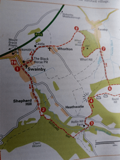
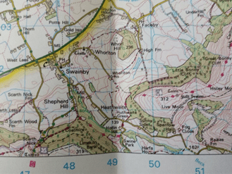
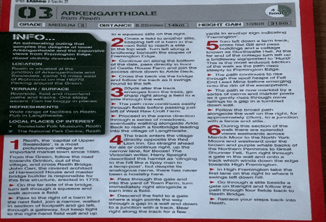
For this walk I used the Yorkshire Dales OL 30 OS explorer map and ’The Dales Pack 2’ walk cards.
This is the third time I’ve completed this walk. The other times, I did one clockwise the other anti-clockwise. On this occasion I decided to go anti-clockwise. The man reason for this was that the climbing and high level part of the walk came at the beginning. I felt it was better to attempt this while I still had the energy rather than in the second half when I was getting tired, but also re-starting after having a lunch break is never easy, and the village of Langthwaite is the natural half way lunchtime point. So, using the ‘Dales Pack’ cards and OL 30 Yorkshire Dales, Wensleydale and Swaledale map I set off from High Fremington. At the end of the walk I stayed on the bridlepath back into High Fremington rather than turning off at a gate down through a field into Reeth as it shows on the Dales pack card.
Today Reeth is the main town in upper Swaledale, but this wasn’t always the case. In Norman times, up until the leadmining times of the 18th and 19 centuries, when Reeth became an important service centre for the mines and smelt mills, it was Grinton, further along the road. Some of the inns and hotels can be traced back to pre-leadmining times.
There is parking in Reeth itself but I was able to find space set back from the road at the edge of Low Fremington, other cars were also parked there, no ‘No Parking’ signs or yellow lines, so I felt settled leaving it. The gives a length of around 8¼ miles and a time of 4-5 hours. With a few photo stops, talking to bike riders and other walkers, and a packed lunch in Langthwaite, I was back at the car in just 4¼ hours.
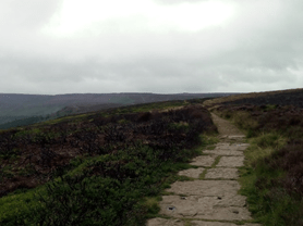
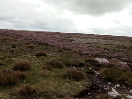
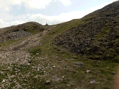
The start is very daunting; steep and difficult underfoot, rising to around 400m. It starts on the road, narrow, tricky and steep up through Fremington. As it reaches houses there is the choice of a steep off road path or stay on the road. I stayed on the road, which turned out to be the better choice as it was smoother going and not as steep. The paths meet at a bridleway. This was the way I returned. Stay on the road as it continues uphill and through Intake Wood. As I walked up this part I was passed by a cyclist and then a car. The car stopped at a house further up the hill, just as the smooth road stops and the rugged, stony path begins. It made me think about how they managed in depths of winter, trying to get up here when the road is covered in snow, or maybe the people there at the moment were using it as a holiday home. At times there was the opportunity to walk on the grass, this came as a big relief from the loose stones and holes in the path.
| The tricky uphill path |
| The tricky uphill path |
Looking up ahead, I noticed the cyclist had also found the terrain difficult and had got off his bike and started walking.
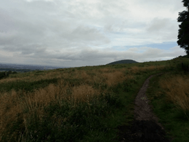
| Lonely on the moor top. |

| Just a few sheep for company. |
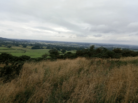
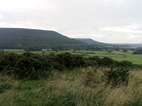
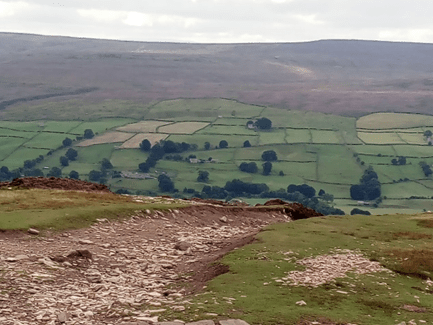
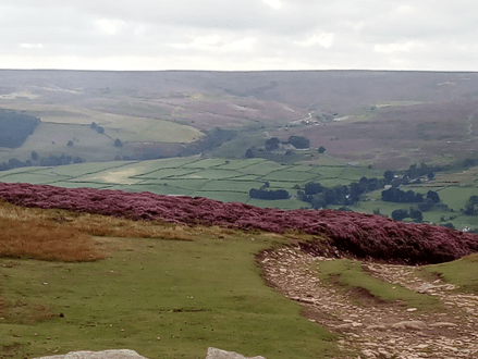
Along the path there are plenty of places in which to stop and take in the view back across the valley beyond Reeth to the fell tops of Reeth Low Moor and Harkerside Moor. These places could also be used as photo opportunities, or, resting places! The man on his bike had stopped in order to make the most of one of these spaces. He was still there when I reached him, so I stopped and had a chat, it would have been rude not to! The bike he was using was rented from the centre in Grinton and motorised. He told me it helped on the smoother parts of the track but was still tricky on the lumpier loose stones. As were talking another cyclist approached, carefully picking his way through, but not stopping. He had an amazing pedalling rhythm and was working hard to maintain it, his eyes fixed on the path. We both looked on in admiration. I made my goodbyes and wished him luck with the remainder of his journey, and continued up the hill, reaching the summit shortly afterwards. At the top there was a gate through a wall, giving the choice of staying in the area I was standing in or walking to the other side of the wall. I decided to go through the gate. For me this seemed the better path as I was able to get really good views back over Reeth again but also across this moor, Marrick moor, towards Helwith and Marske.
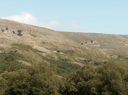
Through the gate it is a left turn, following the wall with fells and moors all around, only sheep for company. However, on the other side of the wall there were some groups of walkers making their way towards the hill I had just climbed. Along this path, a walk of around a mile, with spectacular scenery all around, until breaking off left through a gate towards the spoil heaps left from the old lead mines. It is thought that at one time this area was producing 10% of the country’s lead. The history of lead mining in this area can be traced back to the 2nd century BC and reached its peak during the 18th and 19th centuries.
| Down through the lead mining spoil heaps. |
| Looking up onto the moortop. |
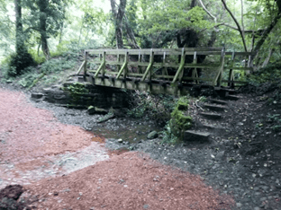
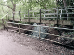
The path is now much wider, and downhill, with the village of Langthwaite in the valley bottom. About halfway down the path takes another left turn, giving the opportunity to look back across the valley to Reeth, now in the distance. From here the path follows the bottom of the cliff, becoming narrower with loose stones underfoot. It emerges at Storthwaite Hall, which, in the early 19th century was a small hamlet in the township and Parish of Reeth. Then over the stream, take a right and, after a few yards, left, back uphill, through a field towards the small settlement of Booze, described as, ‘clinging to the hill like a tipsy man to a lamp-post’ by the Victorian writer Harry Speight. The path goes through a farm then joins a smooth road, the smoothest part of the whole walk! The road goes all the way downhill into Langthwaite. Just after leaving the farm I stopped to watch a kestrel flying close by, eventually landing on a telegraph pole, watching me watching it. So, another descent. I much prefer going uphill, I find descending, regardless of the surface, trickier, especially on the front of the thighs and knees. The entry into the village at he bottom is very steep. I had already decided that I would have lunch in Langthwaite, so, with aching thighs I was glad to find a bench next to the river, and have lunch.
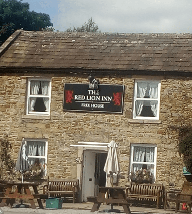
| The Red Lion Inn at Langthwaite. |
Langthwaite is one of the Yorkshire Dales’ lesser known hamlets, a few miles north of Reeth. Its name is old Norse for ‘long meadow or clearing’, which seems accurate as the small settlement hugs the beck after the wild moor. The Red Lion inn was often seen in the original ‘All creatures great and small’ tv series along with the bridge that leads into the hamlet. It would have been a lot busier during the lead mining times.
It was also the end of the first half of the walk and where the change in landscape started. The first half was high level fell and moorland, with spectacular views across them and into the valleys. The second half was to be low level along the valley following Arkle Beck. Views would be mainly of the fields, over and back up to Fremington Edge, looking at the way I had walked. It was surprising how high it looked from down in the valley bottom. I was able to pick out landmarks from where I had been walking earlier. I also got a different perspective of the spoil heaps and how they had altered the landscape.
After a fifteen minute rest for a sandwich and drink, I started out again, following Arkle Beck away from Langthwaite. It is a walk down another stony path until reaching a bridge, a very narrow bridge, one foot at a time to cross. Looking up and down the beck it is dark as the trees almost meet in the middle, letting little light through. Across the bridge, then left and follow a very narrow path alongside the beck, being careful not to trip over the many tree roots sticking out. The river wasn’t deep but I couldn’t see any fish swimming, they’d probably seen me first. The path eventually leaves the riverside and goes across fields. From the fields, through the trees, it is possible to see Fremington Edge very clearly, and the route I took, seeing the face of the hills. This section continued across a series of fields until it eventually meets a narrow lane.
At the lane turn left and back down to the river through a gate. After the gate, following the road to another bridge crossing the river. This bridge is much wider than the one back in Langthwaite, but the views up and down the river are just as interesting, but not as dark! Crossing the bridge the road goes through another gate and uphill, the longest and steepest, climb of this second half of the walk. It widens as it heads up to castle Farm. Bringing me back to the reality of the day was a sign on the gate to the farm at the top of the hill, telling walkers to go round the farmhouse instead of following the path through as the people living there were isolating from the COVID pandemic!
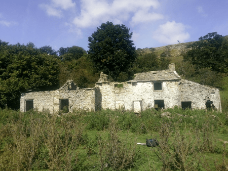
| What is the story that goes with this house? |
After going round the farmhouse the path is now above Arkle Beck and moving further away from it, going through fields and only slightly undulating. Passing through one of the fields, I notice a very interesting ruin, which certainly gets the imagination working overtime. It is a farmhouse, almost all intact, the doors and windows can be made out easily, as can the gar den gate and path. Inside, the buildings are overgrown and the only inhabitants are sheep, unless at night the ghosts of the families that lived there re-appear! With those thoughts in my head I quickly moved on.
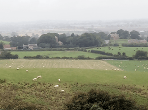
From here the path continues to twist and turn with ups and downs, slippy in places where the sun hasn’t dried up the patches of mud. It eventually comes out onto a bridleway. The walk on the card turns right through a series of fields, some with cows in, a sign warning walkers about this. I had already decided to continue on the bridleway as it meets the steep stony path I walked up at the start. This path stays on the same level, is grassy and wide. From here the village of Reeth comes back into view. It also runs parallel with the road out of Reeth to Fremington where I had parked the car and started the walk. As well as looking down onto Reeth I could look up and follow the path I had climbed three and a half hours earlier.
Reaching the end of the bridleway, returning to the road, I had those mixed feelings, knowing that all the hard walking was done and I could look forward to a rest, drink and hot shower, but also knowing it was back to reality, my escape into the country, peace and quiet, over. From here it was back down the road. I decided to take the narrow path between the houses, the one I ignored at the start. This was steep, very slippy and uneven. I was pleased I hadn’t walked up it earlier. At the bottom it was onto the road, down the hill and back to the car.
There are places to eat and drink in Reeth ranging from tearooms to pubs and hotels. Eleven miles further away is the larger town of Richmond with a wider variety of eating and drinking places, however it would be a shame not to experience fully this jewel in the heart of Swaledale.